Exploring and enjoying the outdoors in California’s Yuba River
Recreation in the Northern Sierra Yuba River region is a mixed bag of river canyons, small-town Gold community history, and wild solitude opportunities. Geologically this region is layered with the final exposure of the Sierra Granite mixed with the ancient volcanic remnants of North Lake Tahoe and the historic mining scars of the past California Gold rush.
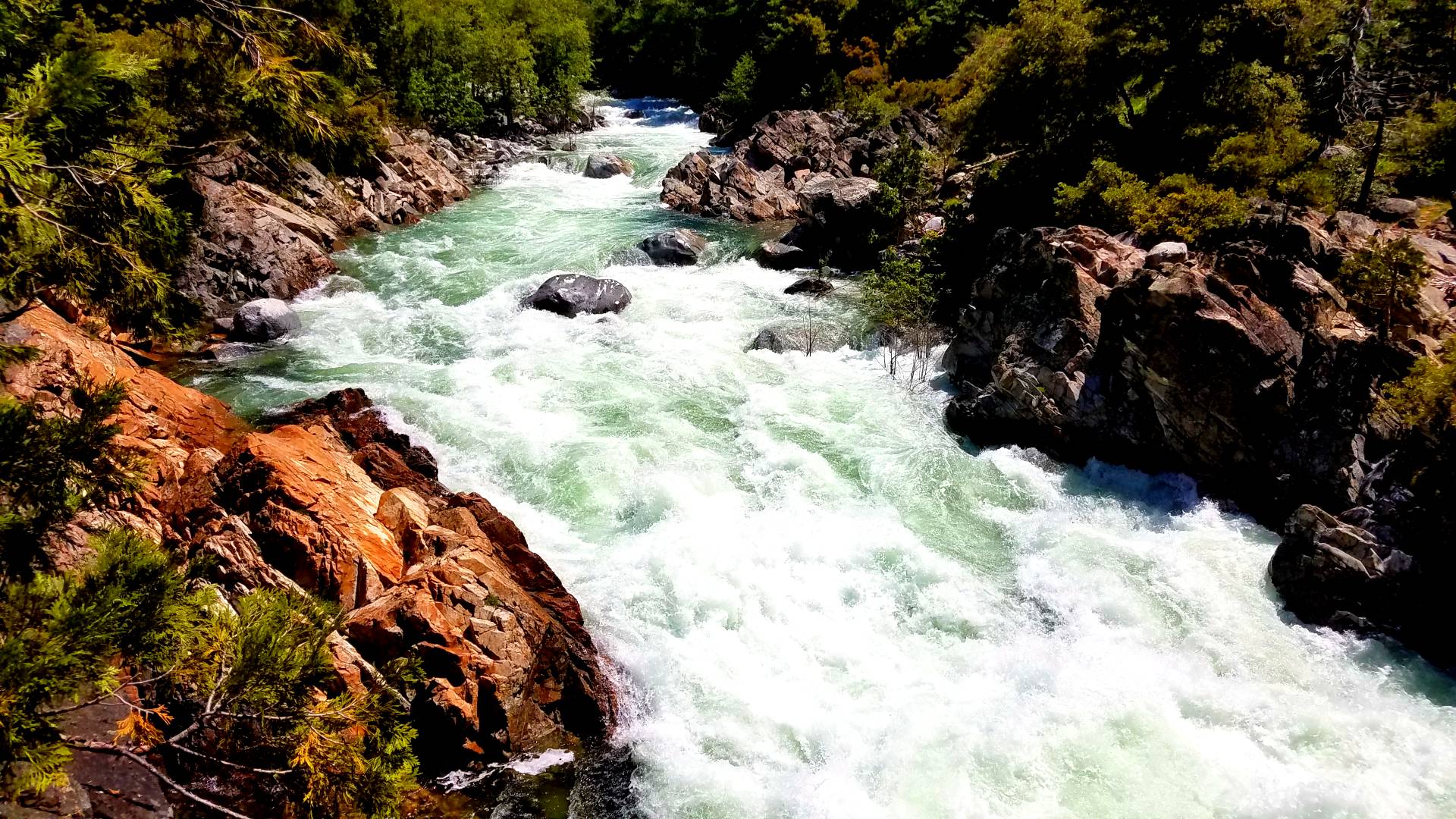
The Yuba River recreation area is divided into Three Spurs North Yuba, Middle Yuba and South Yuba. Three unique regions carve their routes through granite valleys and canyons, leaving steep terrain, sometimes dangerous white water chutes, and plenty of outdoor recreational opportunities for campers, hikers, mountain bikers, and the occasional recreational gold panning.

North Yuba
The North Yuba River, 61.1 miles long, rises at Yuba Pass along California State Route 49, near the eastern boundary of the Tahoe National Forest. It flows southwest, then west through a 3,000-foot-deep (910 m) canyon past the communities of Downieville (where it receives the Downie River from the north) and Goodyears Bar. Its main tributaries, Canyon Creek and Slate Creek join from the north shortly downstream of there. Besides the River gorge region on the West side of the Sierra Crest Hwy 49 and the North Yuba River is also the southern access area to the Gold Lakes Hwy and parts of the Lost Sierra region. In winter, the Yuba Pass Sno-park is a popular destination for snowmobile riders, cross-country skiing and snow show activities.

Virtual Tour ↗
Get a virtual tour of the museum. Ideal for schools and events.
Current Shows ↗
Stay updated and see our current exhibitions here.
Useful Info ↗
Get to know our opening times, ticket prices and discounts.
Areas for Campground Camping at Highway 49
- Cal Ida Campground
- Carlton Flat Campground
- Chapman Creek Campground
- Fiddle Creek Campground
- Indian Valley Campground
- Loganville Campground
- Ramshorn Campground
- Rocky Rest Campground
- Sierra Campground
- Union Flat Campground
- Wild Plum Campground
Areas for Mountain Biking at Highway 49
Areas for Day Hiking at Highway 49
- Brandy City Pond Trail
- Chapman Creek Trail
- Devils Postpile Trail
- Downieville Mt Bike & Hiker Trailhead
- Haskell Peak Trail1
- Haypress Creek Trail
- Loves Falls
- Rocky Rest Trailhead
- Wild Plum Loop Trail
- Wild Plum Pct Access Trail
- Wild Plum Pct Trailhead
Areas for Horse Riding at Highway 49
Areas for OHV Trail Riding at Highway 49
Middle Yuba River
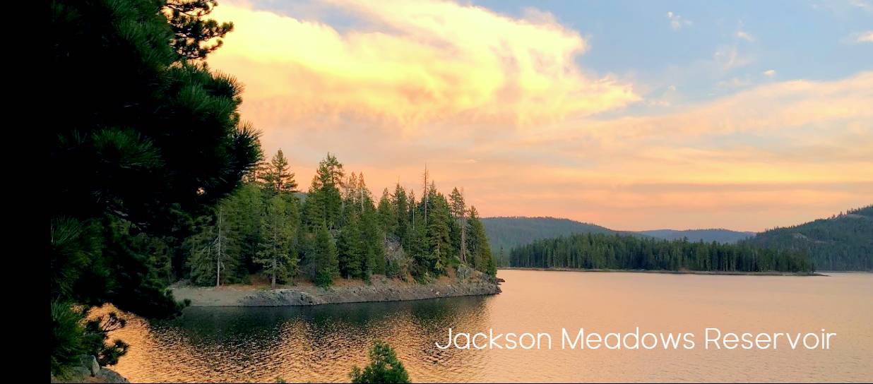
Originating in a bowl-shaped valley in Moscove Meadow, the 55.4-mile-long (89.2 km) Middle Yuba River[2] flows north into Jackson Meadows Reservoir, then turns west, soon entering a steep gorge. The Middle Fork of the Yuba is not an easy-to-access area that requires good map reading skills, solid trail skills and physical willingness to climb steep terrain and travel across sites poorly maintained. The only access is typically old mining roads that are usually only accessible by 4×4. In addition, the vertical canyon walls along this river are sometimes pure cliff. Yet for the fisherman looking for seclusion and good fishing, this area will demand a lot but typically give great rewards. There is a great article written by Kienes fly shop on how and where to access the fishing regions of the Middle Fork of the Yuba.
You get to Middle Fork at the Gates of the Antipodes and the box canyons via Henness Pass Road. Hike down the nondescript four-wheel drive road to the Gates of the Antipodes. The road ends at a derelict log cabin. A very steep, the rocky trail takes you down into the canyon. Several routes lead into the region of the box canyons from the north rim. All require skill in finding trailheads with an absence of notable landmarks. Use the USFS Tahoe National Forest map religiously. Many of the trails need to be better maintained. They are not recommended for novice hikers or those in poor physical condition. Map-reading skills are also important. ~ by Kienes fly shop
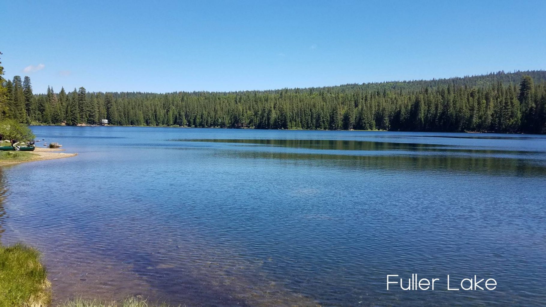
Areas for Campground Camping at Bowman Road
- Bowman Campground
- Canyon Creek Campground
- Carr Lake Campground
- Grouse Ridge Campground
- Jackson Creek Campground
- Lindsey Lake Campground
- Lindsey Lake Trail
Group Camping
Areas for Group Camping at Bowman Road
Areas for Day Hiking at Bowman Road
- Baltimore Lake
- Blue Lake Trail
- Bowman Campground
- Canyon Creek Campground
- Carr Lake Campground
- Crooked Lakes Trail
- Five Lakes Basin Trail
- Glacier Lake Trail
- Grouse Ridge Campground
- Grouse Ridge Trail
- Jackson Creek Campground
- Lindsey Lake Campground
- Lindsey Lake Trail
- Lindsey Lake Trailhead
- Loney Meadows Trail
- Round Lake Trail
- Spaulding Lake Trail
Backpacking
Areas for Backpacking at Bowman Road
Areas for Horse Riding at Bowman Road
Areas for Mountain Biking at Bowman Road
South Yuba River
The 65.3-mile-long South Yuba River originates at Lake Angela in Nevada County, about three-quarters of a mile north of Donner Pass, about three miles east of Soda Springs. After passing through Lake Van Norden with Upper Castle Creek (longer than the Lake Angela stem) entering from the right, it gathers numerous snow-fed tributaries running west through a marshy, lake-filled valley, crossing Interstate 80 several times. The river briefly enters Placer County before flowing back north into Nevada County, then flows into Lake Spaulding, where much of its water is diverted south to the Bear River drainage. The remainder of the river turns northward into a gorge near Emigrant Gap before continuing west. The river continues west into the foothills and into South Yuba River State Park where it is bridged by State Route 49. It joins the Yuba River at the upper end of Englebright Lake.

With many access points and by far the easiest travel routes the South Yuba river is also the most popular for recreational opportunities.
Interstate 80 hiking Trails
- Boca Historic Townsite InterpretiveTrail
- Cherry Point Trail
- Cherry Point Trailhead
- Cold Stream Trailhead
- Donner Summit Pac Crest Trailhead
- Euchre Bar North Trailhead
- Fordyce Foot Trail
- Glacier Lakes Basin Trail
- Glacier Meadow Trailhead
- Government Springs Mumford Bar North Trailhead
- Hampshire Rocks Campground
- Indian Springs Campground
- Indian Springs Trailhead
- Loch Leven Trail
- Loch Leven Trailhead
- Mossy Pond East Trail
- Mossy Pond West Trail
- Mt. Judah Loop Trail
- North Fork Campground
- Palisades Creek Trail
- Pierce Creek Wetland Trailhead
- Salmon Lake Trail
- Salmon Lakes Trailhead
- Sterling Lake Campground
- Summit Lake Trail
- Upper Lola Montez Trail
- Woodchuck Campground
Areas for Backpacking at Interstate 80
Areas for Day Hiking at Highway 20
- Chalkbluff Trailhead (530) 478-6253 Ext. 243
- Doolittle Trail
- Emerald Pools Hiking area
- Gold Country Trailhead
- Pioneer Trail
- Rock Creek Nature Trail
- White Cloud Campground
Areas for OHV Trail Riding at Highway 20
- Burlington OHV System – (530) 478-6253 Ext. 243
- Chalkbluff Trailhead (530) 478-6253 Ext. 243
- White Cloud Campground
Areas for Horse Riding at Highway 20
- Dascombe Cutoff Trail
- Dascombe Trail
- Hallelujah Tie Trail
- Hallelujah Trail
- Meyer Trail
- Pfeiffer Trail
- Pioneer Trail
- Skillman Campground
Areas for Mountain Biking at Highway 20
Areas for Campground Camping at Highway 20
Group Camping
Areas for Group Camping at Highway 20
Areas for Day Hiking at Bowman Road
- Baltimore Lake
- Blue Lake Trail
- Bowman Campground
- Canyon Creek Campground
- Carr Lake Campground
- Crooked Lakes Trail
- Five Lakes Basin Trail
- Glacier Lake Trail
- Grouse Ridge Campground
- Grouse Ridge Trail
- Jackson Creek Campground
- Lindsey Lake Campground
- Lindsey Lake Trail
- Lindsey Lake Trailhead
- Loney Meadows Trail
- Round Lake Trail
- Spaulding Lake Trail
